Table of contents
Iron ham
to travel
Franconian Switzerland – a paradise for motorcyclists
On the go: Franconian Switzerland
Franconian rock garden – a paradise for motorcyclists
The white rock faces of Franconian Switzerland rise into the sky as jagged as the peaks of the Dolomites. What is a world-famous area among climbers also has the right edges and curves for motorcyclists in a maze of small and tiny streets.
Markus Biebricher, Gerhard Eisenschink
08/18/2011
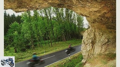
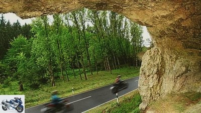
Rocks with half caves are in the upper Wiesent valley right next to the road.
Three hundred kilometers of Franconian Switzerland in one day? Actually, this tour is almost too good to unwind in one day. The landscape is too varied with its half-timbered villages, winding valleys, bizarre rocks and countless many castles in outstandingly beautiful places. And a region with the largest density of breweries in the world – Aufseb even made it into the “Guinness Book” – invites you to spend the night with an extensive beer tasting. But if you have to, dear reader, this is the region to spend a day with a corresponding inclination. The tour begins in Lauf. From exit 49 of the A 9 either a short detour west to the interesting half-timbered town of Lauf or from the exit just east towards Hersbruck / Sulzbach-Rosenberg (not exactly to Schnaittach, which is approached via a detour worth seeing). Two kilometers after the exit, turn left towards Schnaittach (do not accidentally turn left into the Ottensoos industrial park beforehand). After one kilometer in Speikern turn right towards Kersbach / Siegersdorf, but before Siegersdorf left steeply up the mountain (even with a serpentine) to Rabenshof and on a small road through the forest to Schnaittach. In the village right towards Hiltpoltstein / Simmelsdorf and in Simmelsdorf right right towards Diepoltsdorf. There left to Grob-engsee and Hiltpoltstein. In the village with the steep castle rock right through the old gate and on the B2 five kilometers to the junction left to Obertrubach.
Buy complete article
On the go: Franconian Switzerland
Franconian rock garden – a paradise for motorcyclists
6 pages) as PDF
€ 2.00
Buy now
There at the church on the left, following the main road and the Trubach valley along steep cliffs and high-altitude castles via Wolfsberg, Ergloffstein to Pretzfeld. In the village, at the first crossroads, turn right to Ebermannstadt, where you meet the B 470 and follow it to the right into the Wiesent valley, which is becoming ever narrower and more beautiful (write to Weiden / Bayreuth, then Behringersmuhle). This icing on the cake route in Franconian Switzerland is followed to Behringersmuhle. There left over Waischenfeld towards Hollfeld.
Iron ham
Nankendorfer Muhle: There is currently no risk of flooding from the Wiesent.
Before Plankenfels at the crossroads, turn left to Aufseb, the place with the highest density of breweries in the world, but whose temptations are better resisted around the middle of the day and instead continue in the direction of Heiligenstadt. Before Heiligenstadt at the T-junction right towards Scheblitz / Zoggendorf and in Burggrub right again towards Scheblitz. This is followed by a beautiful valley stretch, which then leads up and on the left reveals views towards Bamberg and the Albrand as a steep drop. In Scheblitz on the sometimes wonderfully winding B 22 towards Hollfeld / Bayreuth through the upper part of the Wiesent valley, which was known from the beginning of the tour. But there still has to be a worth seeing detour: 15 km after Scheblitz on the B 22 in Treunitz left to Eichenhull and Stadel-hofen. Another jewel of Franconian Switzerland begins here, the Kleinziegenfelder Tal, which you can follow for four kilometers with writing on Weismain through almost alpine-looking rocky scenarios. Then turn left and with the letter Wallersberg / Mosenberg / Frankenberg up a steep rock face – one of the most prominent parts of the tour.
From Frankenberg to Weismain and in the village with its beautiful market square, head back towards Wallersberg and through the Kleinziegenfeld valley with the letter Kleinziegenfeld / Stadelhofen back to Treunitz and left further in the Wiesent valley, which can absolutely compete with the Kleinziegenfelder valley in terms of landscape. In Hollfeld leave the B 22 on the right (written on Behringersmuhle) to Waischenfeld and follow the Wiesenttal to Behringersmuhle. There you come across the B 470, on which you should definitely make a detour via Tuchersfeld (probably the most famous rock house ensemble in Franconian Switzerland) to Pottenstein and back on the same route. The pilgrimage site of Gobweinstein could also be reached quickly as a short detour from the Behringersmuhle intersection. Then with God’s blessing in Behringersmuhle turn into the next creamy route, the Ailsbach valley, which you follow curvy to Ahorntal. There right to Trockau, where there is already a connection to the A 9, if time is running out. Otherwise, complete the round by driving right to Pegnitz after passing under the A 9 (write to Creussen / Pegnitz). Drive through the charming city with its half-timbered architecture on the B 85/470 (letter A 9). At the motorway exit towards Nuremberg, a little road goes right through the Veldensteiner Forest, which leads to Plech. In the village left to Neuhaus and in the beautiful Pegnitz Valley via Velden, Vorra to Hersbruck with its old town well worth seeing. Direction A 9 / Lauf you reach the starting point of the tour after a few kilometers.
Info
Iron ham
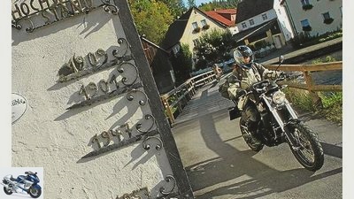
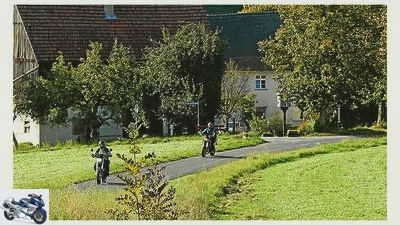
God’s blessing on winding roads: You have to be grateful for these routes. Village romance near Waischenfeld in Wiesenttal.
Route length: around 310 kilometers
region
As part of the Franconian Alb, Franconian Switzerland is characterized by steep white limestone cliffs. In between, winding roads wind through natural valleys with mills, ponds and half-timbered villages.
Directions
From the west: to Nuremberg, then A 73 Bamberg. Forchheim Sud exit, B 470 towards Wiesenttal / Pottenstein. From the east: A 9 (Berlin, Bayreuth, Nuremberg), exit 49, Lauf / Hersbruck.
Blockages
No general line closures, but rigorous speed controls on beautiful stretches.
Break tips
Brewery Bruckmayer in Pottenstein (www.hotel-bruckmayer.de), Krug-Brau in Breitenlesau, Hubner-Brewery in Steinfeld (www.huebner-braeu.de).
Biker meeting
Kathi-Brau is cult: The Kathi-Meyer-Brauerei in Heckenhof 1 not far from Aufseb is THE magnet for motorcyclists on the weekends. Those who want it quieter come during the week. Open from 9 a.m., phone 0 91 98/2 77.
Stay
In Aufseb, the Guinness record location with the highest brewery density, you can spend the night in a brewery: Gasthof Reichold, Hochstahl 24, 91347 Aufseb, phone 0 92 04/2 71, www. reichold.de. In the center of the region: Gasthof Drei Linden, Dorfstrabe 38, 91286 Obertrubach (www.drei-linden.com).
Literature / maps
“Franconian Switzerland”, Michael Muller Verlag, 15.90 euros, Marco Polo card “Bavaria North” MairDumont, 1: 200,000, 8.50 euros.
Addresses
www.fraenkische-schweiz.com, www.burg-rabenstein.de, www.fs-biker.de, www.burgpottenstein.de, Brunners Oldtimer-Museum, Tel. 0 92 45/12 31.
Related articles
-
Over the mountain race routes in Franconian Switzerland
fact to travel Over the mountain race routes in Franconian Switzerland Life: Over the mountain race routes in Franconian Switzerland It’s a pleasure to…
-
MOTORCYCLE tour tip – Switzerland passes tour
Tour tips Exclusive motorcycle tours for children to follow Presented by Dirk Schafer to travel MOTORCYCLE tour tip – Switzerland passes tour MOTORCYCLE…
-
MOTORCYCLE tour tip – Alternative Switzerland tour
Tour tips Exclusive motorcycle tours for children to follow Presented by Dirk Schafer to travel MOTORCYCLE tour tip – Alternative Switzerland tour…
-
Motorcycle tour in eastern Switzerland: Appenzell
Iron ham to travel Motorcycle tour in eastern Switzerland: Appenzell Motorcycling in Switzerland Motorbike tour through the Appenzellerland Granted, the…
-
Motorcycle day tour: Austria – Italy – Switzerland
Dentges to travel Motorcycle day tour: Austria – Italy – Switzerland Motorcycle day tour: Three-Country Giro Motorcycle day tour: Austria – Italy -…
-
MOTORCYCLE tour tip – Switzerland Gantrisch Nature Park
Tour tips Exclusive motorcycle tours for children to follow Presented by Jorg Kunstle to travel MOTORCYCLE tour tip – Switzerland Gantrisch Nature Park…
-
Fichtel Mountains – Franconian Forest
to travel Fichtel Mountains / Franconian Forest Fichtel Mountains / Franconian Forest Gentle border area Two forest mountains meet in the northeast…
-
Iron ham to travel Tour tip Northern Alps Tour tip Northern Alps Berchtesgaden Alps Gerhard Eisenschink 04/22/2009 The northern edge of the Alps offers…
-
Tour tip: Motorcycling in the Black Forest
Iron ham 17th pictures Iron ham 1/17 Motorbike tour in the Black Forest: It cannot be emphasized enough: The attraction of riding a roller coaster on a…
-
to travel Franconian Forest Franconian Forest At the top in Bavaria At the northernmost end of Bavaria, nestled close to the Thuringian border, the…