Table of contents
- Bike & Hike in the German Alps climber
- Info about the tour
- Bike & Hike in the German Alps (3)
- Bike & Hike in the German Alps (2)
- Tips for mountain tours
Iron ham
to travel
Bike & Hike in the German Alps
Bike & Hike in the German Alps
climber
You could almost overlook the eastern outpost of the German Alps, so hidden in the embrace of Austria. But the Berchtesgadener Land, flanked by jagged two-thousand-meter peaks, not only offers bikers the best conditions. Time for something new?
Sylvia Lischer
06/24/2005
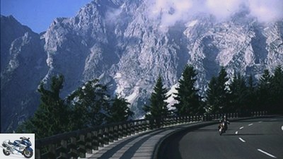
Icy wind sweeps around the last bend before the almost 1,600 meter high Robfeld. I tighten my jacket collar, park the BMW F 650 CS and see the first pink glow on the Alpine peaks all around. Left in Salzburg, right in Berchtesgadener Land. Right in front of me, like on a cinema screen, the rocky summit region of the Hohen Goll. It’s just before six and the sun is just beginning to rise.
As it gets lighter, more spectators of the natural spectacle can be seen all around on the Robfeld-Hohenringstrasse. A hunter, two couples in convertibles and Achim from Bad Reichenhall, who is eating a breakfast roll next to his BMW R 100 GS. After a while, the convertibles disappear in the direction of the valley, the hunter in the bushes and Achim, who, like me, came with mountain boots and a backpack, on the summit trail to the Hohen Goll. Five kilometers, 990 meters in altitude. Sounds exciting, but exhausting. The sticks are still in my luggage. While bright fleecy clouds float around the Tennengebirge, Dachstein and Untersberg mountains, the last lights go out a thousand meters below in the Salzach Valley, I let the BMW roll through the sleek bends down into the valley of the Berchtesgadener Ache.
Despite the early hour, there is already heavy holiday traffic on the main road to Marktschellenberg. I study the map and turn to a thinly marked side path along the Austrian border. One or the other farmhouse appears, in between nothing but forest, pastures and meadows. Except for a few cackling geese at the Gasthaus Zill, this outermost corner of Germany seems to be in a gentle deep sleep.
Buy complete article
Bike & Hike in the German Alps
climber
10 pages) as PDF
€ 2.00
Buy now
Iron ham
Just leave the bike behind …
“Very tight bends!” The sign in Marktschellenberg is full of promise and the following little street is just as wide as a courtyard entrance. Hit! In front of me is the entrance to Hohenringstrasse on Ettenberg – the little sister of Robfeldstrasse, so to speak. The road climbs quickly upwards and winds past geranium-adorned farmhouses with a view of the long rocky ridge of the Untersberg. Unterettenberg, Hinterettenberg, Vorderettenberg and finally the pilgrimage church of the Visitation of Mary, where Saint Christopher is enthroned 4.30 meters high next to the church organ. “Patron saint not only of car drivers, but also of motorcyclists,” emphasizes the pastor, who probably knows the rush of curves that followed. In fact, after a short stretch of forest, it goes boldly down the Ettenberg. Lean left, right, left. When the asphalt ends unexpectedly, I come to a lurching stand on loose gravel. You have reached the ninth station of the Marktschellenberger Kreuzweg. Station of the cross station by station of the cross I bump with difficulty back into the valley.
And straight to the Almbachklamm. The path through the three kilometer long gorge is a must. Just because of the wild and romantic route over 320 rock steps, 29 bridges and along thundering waterfalls. First contact with the hiking trails and not that bad at all.
A little later – and already back on the bike – things get highly political. The Obersalzberg lies behind Berchtesgaden. Narrow lane, tight curves, over 20 percent incline. Similar to the Ettenberg, only here the original idyllic village of German history fell victim. In 1933, Hitler made Obersalzberg his Alpine branch. The NSDAP drove out the residents, tore down the farmhouses and declared Obersalzberg to be a restricted area for the Fuhrer. What was left of the ensuing air raids in World War II was then under the control of the US Army until 1996.
Info about the tour
Map: Mairs / Maucher
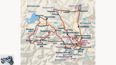
Distance covered: around 450 kilometers
Magnificent mountains, perfect tourism infrastructure and an exciting alternative program to pure curve milling – the German Alps offer more than coffee in a pot and the hit parade of folk music.
Arrival and toll
The quickest way to get there is via the A 8 Munich – Salzburg to Bad Reichenhall. Even if toll roads are the exception in this country – the Robfeld-Hohenring-Strabe costs 2.50 euros for motorcycles.
Stay
A great starting point for cross-border motorcycle tours is the Grenzgasthaus Neuhausl, Wildmoos 45 in 83471 Berchtesgaden-Oberau, phone 08652/9400 or www.neuhaeusl.de, email: info@neuhaeusl.de. An overnight stay with breakfast costs from 36 euros per person.
The guest house Binderlehen, Oberschonauer Strabe 30 in 83471 Schonau am Konigssee offers a magnificent mountain view. From 29 euros per person, phone 08652/62658. If you want to camp, you can enjoy a no less great view from the Allweglehen campsite in 83471 Berchtesgaden-Unterau, phone 08652/2396 or www.alpen-camping-allweg.de, email: campingplatz.allweglehen@t-online.de. A tent is estimated at 8.20 euros, each person with an additional 4.50 euros.
Worth seeing
If you don’t want to hike, you should at least treat yourself to the boat trip across the Konigssee. Tip: start before nine o’clock to avoid the large number of visitors and get a slightly discounted good morning ticket. The Konigssee – Salet route, for example, then costs 12.20 euros there and back. All information is available from Schifffahrt Konigssee, phone 08652/963618 or www.bayerische-seenschifffahrt.de. The approximately three kilometer long and wildly romantic gorge of the Almbachklamm near Marktschellenberg is also a great natural spectacle. Information on phone 08652/9670.
Anyone interested in the Third Reich should not miss the documentation on the Obersalzberg. The Munich Institute for Contemporary History uses state-of-the-art multi-vision technology to provide information about Hitler’s Alpine base. Telephone 08652/947960 or www.obersalzberg.de.
It gets even older in the Mammutheum Adventure Museum and Stone Age Park between Siegsdorf and Bergen. Telephone 08662/12120 or www.mammutheum.com.
literature
You can get a good overview with the HB Bildatlas No. 178 “Chiemgau, Berchtesgadener Land” for 8.50 euros. Further tour tips for directly neighboring regions can be found in the Edition Unterwegs volumes “German Alps” and “Austria” for 16 euros each. The Mairs general cards in 1: 200000 are ideal for orientation. Either in the large paper no. 12 “Bayern Sud” or as a smaller MOTORRAD pocket edition no. 20 “Munich, Innsbruck, Salzburg”. The Allianz Leisure Map No. 37 “Eastern Bavarian Alps” on a scale of 1: 100,000 is even more precise.
information
Berchtesgaden Tourismus GmbH, Konigsseer Strabe 2, 83471 Berchtesgaden, phone 08652/9670, fax 967402 or www.berchtesgadener-land.com.
Bike & Hike in the German Alps (3)
Iron ham
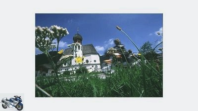
Yarrow, onion domes, alpine pastures …
Off to the Konigssee, where the Alpen-Express is already jingling its laps and you can buy one or the other hiking accessory: hiking sticks, optionally with a cowbell or whistle for lost children, traditional clothing for dogs and the plush toy “Babe Pig at Konigssee” swirling like a pinball through its cardboard box.
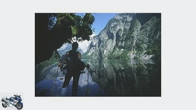
I catch the first boat to cast off and we chug towards the west bank at 16 km / h. A couple of hikers are on board, a national park attendant on the way to work and Roland Fuchs, who demonstrates the echo of the Konigssee with his “flugelhorn”. The church of St. Bartholoma appears, behind it the vertically towering east face of the Watzmann, on which almost 100 mountaineers have lost their lives so far. Here we dock, immerse ourselves – only a few kilometers away from Piggy Babe in a cardboard box – in a nature completely removed from civilization.
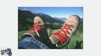
The boat disappears, and silence descends on the paths and climbs that run past giant gnarled trees and fern forests through the 460 square kilometer Alpine National Park. I walk a bit along the shore, then the ascent to the Kuhrointhutte begins. Stones crunch under your soles, marmots whistle. I lace my shoes tighter and make my way to the pulpit. “Via ferrata, only for the experienced”, says the map. The so-called Rinnkendelsteig actually leads steeply up the rock and quickly gains height. I carefully put foot to foot, small stones roll into the valley, in some places only a wire rope secures the step, which has been hewn hard into the rock. The bottle-green Konigssee spreads deeper and deeper below me. Just don’t get dizzy. 800 meters in altitude are up to the highest point. Cool air from the lake brushes the heated muscles. After a good two and a half hours, the Achenkanzel with its amazing view is reached, another half an hour later the Kuhroint Alm. Exhausted, the buttermilk on offer rushes down in one gulp, the sandwiches follow quickly. Hiking makes you hungry. And tired.
Iron ham
Where the roads end, new paths have to be discovered.
So that was “medium level of difficulty”, as I doze off on a sun-warm wooden bench in the hiking guide and get to know completely unknown leg muscle groups. Now the descent. But now it’s easier, the path gradually falls back to sea level through the forest, wide and shady. A few meters and I’m back in the parking lot at Konigssee. Finally, the BMW! Thankfully I sink into the saddle, we roll off. Just don’t move anymore.
In the north, the traffic on the other side of the A 8 slowly subsides, the little road winds over gently green hilltops, with the Berchtesgaden Alps at the back. No more souvenir shop, at best a tractor or the top of a village church. I am definitely ripe for solitude. Behind the Waginger See I draw an arc over Salzburg and Hallein back to Berchtesgaden. I’m just in time when the Alpine peaks begin to glow pink on the way up to the Robfeld. Left the Salzburg, right the Berchtesgaden. It’s just before sunset. The rise seems to have been years ago.
Bike & Hike in the German Alps (2)
Iron ham
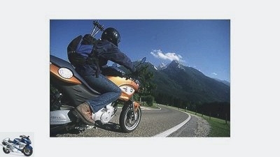
The area offers tons of mini-streets.
In front of the “Zum Turken” hotel – the command center of the Reich Security Service in the Third Reich – there are three bistro tables and an ice cream flag is blowing in the wind. After all these decades, so the boss, the inn is again in family ownership. Vine tendrils climb up the wooden balconies, glowing geraniums gush from the flower pots – alpine cosiness seems to seep from every pore. Except for the basement, where unchanged prison cells, loopholes and an entrance to the three-kilometer-long driver’s bunker remind of the unhappy times.
The underground labyrinth continues uninterrupted on the surface: Scharitzkehlstrasse, Salzbergstrasse, Rennweg. The BMW hums along three-dimensionally nested mountain roads, on which even the 1: 200,000 map can hardly help. Soon even the Watzmann appears, Germany’s second highest mountain. With its jagged ridge and the 2712 meter high central peak, it is no less distinctive than the record holder of the Zugspitze. Including the almost 2000 meter high Watzmann east face – a vertical desert made of stone.
Contrasting program a little later in Berchtesgaden. Idyllic alleys, houses with Luftlmalerei, pralines, honey schnapps, master, Edel- and Barwurz in the shop window of Grassel’s Enzianbrennerei. The National Park House on Franziskanerplatz recommends a guided hike to the Karlingerhaus on the Funtensee: Salet, Sagereckwand, Grunsee and back over the Saugasse to St. Bartoloma, tour start at the Konigssee car park in 15 minutes.
Iron ham
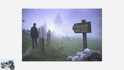
Hiking can be nice even in fog.
Before I get off my motorcycle for a longer trip, however, I let myself be guided from Alte Reichenhaller Strabe to a classic local road construction – the German Alpine Road. It twitches briefly, then the BMW catches fire and we speed off towards Inzell. All hiking plans are promptly forgotten, asphalt, slopes and braking points now determine the perception. When I come to my senses again, the gently green hills of the Bavarian Alpine foothills can already be seen, the jagged limestone Alps are behind me.
But already west of Ruhpolding, the alpine road meanders back into the mountains in perfectly formed arches, as it is called. The Forchensee appears on the left, shining silvery, followed by Lodensee, Mittersee and Weitsee. Crystal clear waters, rainbow trout just below the surface of the water, wooded islands and picturesque reed bays invade consciousness. Winkelmoosalm junction. A narrow toll road winds quickly up the mountain, past alpine huts, herds of cows, ski lift stations and finally ends with a brilliant view of the Loferer Steinberge. Rosi Mittermaier’s piste area from the wild 70s. After looking at the map, the next stage destinations are clear: Reit im Winkl and Kossen in the Austrian Kaiser-winkel. If it is angles, then right.
I’m driving rapidly towards Austria and soon the rocky ridge of the Wilder Kaiser appears like a silhouette. From here the Tiroler Ache takes over the escort to the north. Via Marquartstein to Schnappenwinkl, from there to Grabenstatt-Winkl and past Heinrichswinkl to Chieming. Where I can see almost as far as the Malerwinkel near Gstadt from the landing stage on Chiemsee. It is getting dark when I roll back to Berchtesgaden at the end of the Winkel tour. And it is still dark when the clock radio throws the first Alpine yodel into the hotel room the next morning. Hiking sticks, mountain boots and a snack package are ready and the planned hiking trip through the Berchtesgaden National Park can begin.
Tips for mountain tours
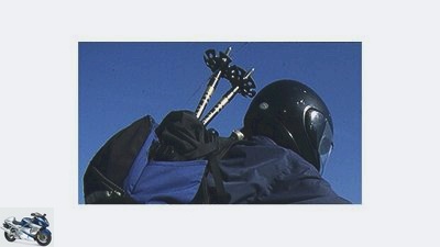
Iron ham
Practical when hiking, not when biking: hiking sticks.
Those who want to combine a mountain tour by axle with one by foot are in good hands in the Berchtesgaden Alps. Above all, the 210 square kilometer Berchtesgaden National Park, which encompasses the southern part of the Alpine region, contains a multitude of paths and via ferratas as well as plenty of huts for one-day or multi-day tours. The degree of difficulty is usually specified precisely and ranges from committed walks with boat trips to challenging via ferratas for alpinists. Due to the geological structure and the formation of imposing trough valleys, which for example form the basis for the Konigs- and Obersee, as well as rugged, wild summit regions, the terrain is extremely varied.
The main routes within the national park are well signposted, and you can put together your first tours with an overview map from the tourist office or the national park administration. Those who want to deal more intensively with the topic can find detailed information in the handy Kompass hiking guide No. 920 “Berchtesgadener Land”. For 11.95 euros, it contains 50 detailed tour descriptions with maps, elevation profiles and a classification according to levels of difficulty. In addition, a topographical map in about 1:50 000 (for example compass sheet 14) helps for orientation. All you have to do is lace up your hiking boots, pack your rain gear, water bottle and sandwiches in your backpack, and you can go hiking. Conveniently, hiking in the mountains is not particularly expensive in terms of equipment, and things can be easily stowed in motorcycle luggage. For overnight stays in managed huts, a thin sleeping bag is usually sufficient. In addition, the national park administration, together with the Berchtesgaden spa directorate, offers guided hikes and mountain tours and also arranges state-certified mountain guides for more extreme climbing. Information material, overview maps, tips for hikes and mountain tours as well as mountain hut directories are available from the National Park House Berchtesgaden, Franziskanerplatz 7 in 83471 Berchtesgaden, phone 08652/64343, or www.nationalpark-berchtesgaden.de.
Related articles
-
Iron ham to travel Tour tip Northern Alps Tour tip Northern Alps Berchtesgaden Alps Gerhard Eisenschink 04/22/2009 The northern edge of the Alps offers…
-
The Alps in focus: around the Triglav
Seitz to travel The Alps in focus: around the Triglav The Alps in focus: around the Triglav Triglav tour Slovenia marks the southeasternmost outpost of…
-
Iron ham to travel Allgau / Lechtal Alps Allgau / Lechtal Alps River walk Cows, cheese and curves are the constant companions between the Lechtal and…
-
Johann to travel Swiss Alps Swiss Alps The Gotthard Shattered, pierced, splinted ?? or when traffic turns to fate and a mountain under its wheels….
-
Tour tip for the Bavarian and Tyrolean Alps
shepherd 14th pictures shepherd 1/14 Tegernsee Tour: Escape from the city is made easy on Tyrol’s side streets. Postcard motifs included. shepherd 2/14…
-
Royer to travel Eastern Alps Eastern Alps Over the peaks to the Adriatic Without detours from Austria to Croatia ?? With their KTM enduros, father and…
-
MOTORCYCLE tour tip – With a team through the Allgau Alps
Tour tips Exclusive motorcycle tours for children to follow Presented by Jorg Kunstle to travel MOTORCYCLE tour tip – With a team through the Allgau Alps…
-
Motorcycle tour tour tips Aosta Valley Italian Alps
Jo Deleker 19th pictures Jo Deleker 1/19 After these 15 dead ends in the Aosta Valley, you will love dead ends. Jo Deleker 2/19 Dead ends in Aosta. Jo…
-
Schroder to travel Alps Alps The dream of endless curves A motorway connects Lake Lucerne with Lake Maggiore. But who cares about a direct connection…
-
Rolf Dieffenbach is dead – motocross legend had an accident in the Alps
Lothar Kutschera Sports & scene Motorsport Rolf Dieffenbach is dead – motocross legend had an accident in the Alps Rolf Dieffenbach is dead Motocross…