Table of contents
- On the go: top alpine passes The 10 best alpine passes in France
- Info
- 1st place: Col d’Izoard
- 2nd place: Col de la Bonette
- 3rd place: Col du Galibier
- 4th place: Col de l’Iseran
- 5th place: Col d’Allos
- 6th place: Cormet de Roselend
- Place 7: Col du Petit St. Bernard
- 8th place: Col Agnel
- 9th place: Col de la Cayolle
- Place 10: Col de Vars
Lengwenus
25th pictures
Werel
1/25
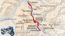
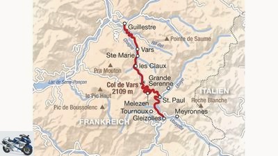
The route over the Col de Vars.
Lengwenus
2/25
Place 10: Col de Vars – Length: 34 kilometers • Height: 2109 meters • Opening times: May to October • Maximum gradient: 11 percent • Special features: ascent almost without switchbacks.
Werel
3/25
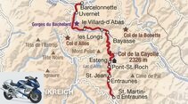
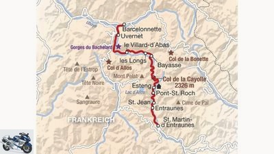
The route over the Col de la Cayolle.
Lengwenus
4/25
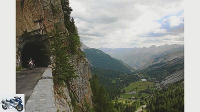
9th place: Col de la Cayolle – Length: 51 kilometers • Height 2326 meters • Opening times: July to October • Maximum gradient: 11 percent • Special features: the flat sections are the most fun.
Werel
5/25
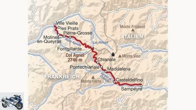
The route over the Col Agnel.
Lengwenus
6/25
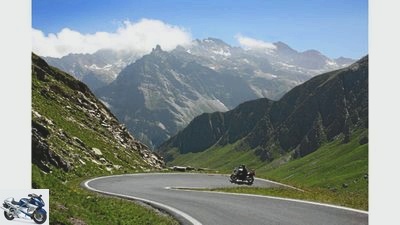
8th place: Col Agnel – Length: 52 kilometers • Height: 2746 meters • Opening times: June to October • Maximum gradient: 11 percent • Special features: very curvy in the east, almost an expressway in the west.
Werel
7/25
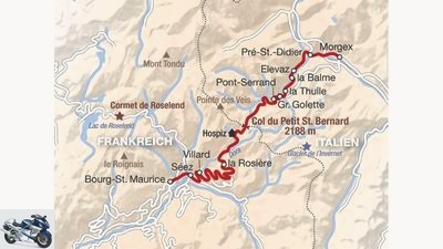
The route over the Col du Petit St. Bernard.
Lengwenus
8/25
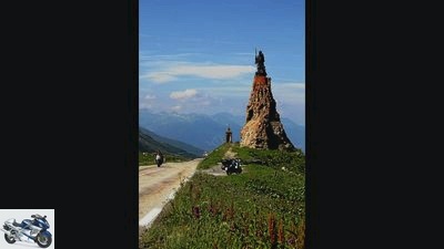
7th place: Col du Petit St. Bernard – Length: 51 kilometers • Height: 2188 meters • Opening times: May to November • Maximum gradient: 10 percent • Special features: one of two passes that lead to Italy.
Werel
9/25
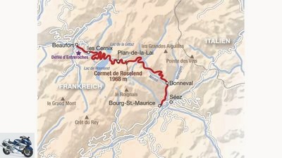
The route over the Cormet de Roselend.
Lengwenus
10/25
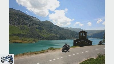
6th place: Cormet de Roselend – Length: 41 kilometers • Height: 1968 meters • Opening times: May to November • Maximum gradient: 11 percent • Special features: Not called like a pass, but it is one.
Werel
11/25
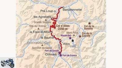
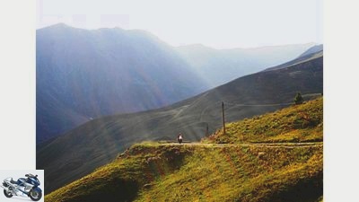
The route over the Col d’Allos.
Lengwenus
12/25
5th place: Col d’Allos – Length: 43 kilometers • Height: 2250 meters • Opening times: June to October • Maximum gradient: 11 percent • Special features: narrow, but fun.
Werel
13/25
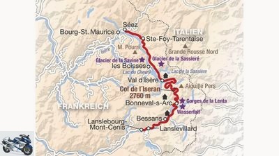
The route over the Col del’Iseran.
Lengwenus
14/25
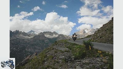
4th place: Col de l’Iseran – Length: 49 kilometers • Height 2770 meters • Opening times: June to October • Maximum gradient: 12 percent • Special features: the most varied.
Werel
15/25
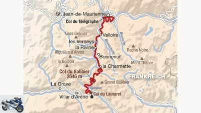
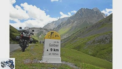
The route over the Col du Galibier.
Lengwenus
16/25
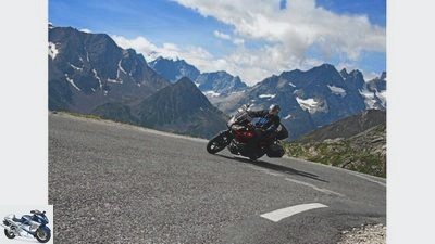
The Galibier is one of the sacred mountains of the Tour de France. For motorcyclists it is a pleasure without any torture.
Lengwenus
17/25
3rd place: Col du Galibier – Length: 44 kilometers • Height: 2646 meters • Opening times: June to October • Maximum gradient: 12 percent • Special features: actually consists of three passes.
Werel
18/25
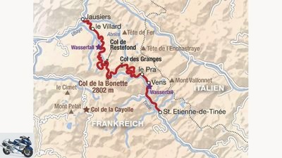
The route over the Col de la Bonette.
Lengwenus
19/25
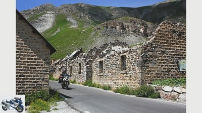
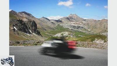
Once the Col de la Bonette was strategically important, today the military camp is a ghost village.
Lengwenus
20/25
2nd place: Col de la Bonette – Length: 49 kilometers • Height 2802 meters • Opening times: July to October • Maximum gradient: 14 percent • Special features: The highest alpine pass ever.
Werel
21/25
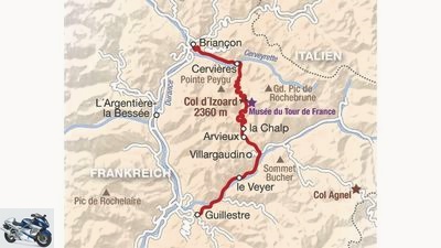
The route over the Col D’Izoard.
Lengwenus
22/25
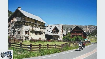
The Izoard impresses with old barns and ancient rocks. But the unique landscape is complemented by great driving pleasure on perfectly paved roads.
Lengwenus
23/25
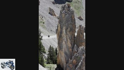
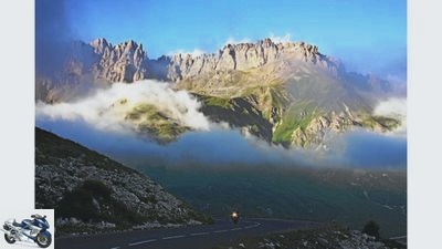
1st place: Col D’Izoard – Length: 49 kilometers • Height: 2360 meters • Opening times: June to October • Maximum gradient: 12 percent • Special features: unique landscape.
Werel
24/25
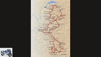
Our route leads over a total of 26 passes, including those that just slipped out of the top ten.
Lengwenus
25/25
In our series “the best alpine passes in Europe” France is the last country on the agenda. As always, we will show you the selection of the 10 best Alpine passes from this country, as well as their routes.
to travel
On the go: the 10 best alpine passes in France
On the go: top alpine passes
The 10 best alpine passes in France
In three issues of MOTORRAD we showed the ten best alpine passes in Switzerland, Austria and Italy. Here is the last part of the series: The ten best passes in France.
Daniel Lengwenus
09/30/2010
France is the alpine country of superlatives. The highest mountain in Europe and three of the four highest mountain passes in the Alps are located on the soil of the Grande Nation. Accordingly, the winter closure is longer on some pass roads than elsewhere. But the wait is worth it. Monumental mountain landscapes of all kinds, the most varied routes on mostly impeccable asphalt, and without any tolls or speed limits. Did we mention good food? So there’s nothing like getting in the saddle before winter comes, or looking forward to an unforgettable ride next year.
Buy complete article
On the go: top alpine passes
The 10 best alpine passes in France
12 pages) as PDF
€ 2.00
Buy now
Info
archive
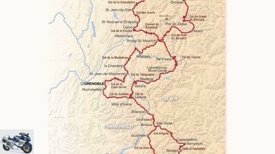
Travel time: six days – distance covered: 2,400 kilometers.
Because of the large number of cyclists, most of the passes are in excellent condition. With all riding fun on a motorcycle, the following principle applies: bikers without a motor are also people.
Werel
Our route leads over a total of 26 passes, including those that just slipped out of the top ten.
Ride:
The best time to travel outside of the holidays is at the end of June or September. French country roads generally do not cost tolls. For crossing Switzerland, 29 euros are due for the vignette. In some valleys, the faster motorway is recommended despite the toll (peage). After thousands of bends, gearshifts and braking maneuvers, thirty kilometers of rolling along an almost straight stretch has an almost therapeutic effect.
Stay:
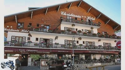
The trip to Jerusalem begins at around 6 p.m. during the July and August holiday months. After 8 p.m. the hotelier asks if you have a tent with you. In spite of the various large castles in the numerous ski villages, there are few rooms. Either they are holiday apartments or the hotels are closed in summer. It is advisable to book rooms in advance. A tip: The Christiana Hotel in Valloire am Galibier, www.christiana-hotel.com
bull
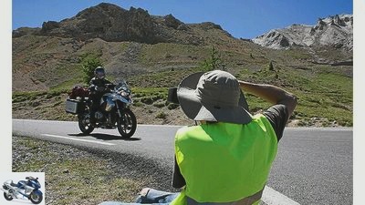
Photo agencies offer their services on some passes. The photos can be downloaded from the Internet.
Memories:
At the Col de la Bonette, the Galibier and some other routes, employees of photo agencies take photos of the bikers with and without motorization. If you want professional souvenir photos of yourself, pay attention to the signs with the web address and when you return you can download your own bike for a few euros in front of a grandiose backdrop.
Extra tour:
If you can’t get enough of driving the passes, you can register for the Alpine Challenge with the MOTORRAD action team. Every year at the end of August, with the exception of the Col d’Iseran, all the top routes in the French Alps are on the program – plus 109 other passes. www.actionteam.de
1st place: Col d’Izoard
Lengwenus
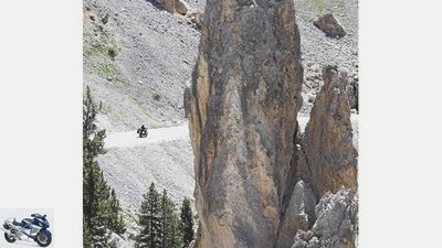
The Izoard impresses with old barns and ancient rocks. But the unique landscape is complemented by great driving pleasure on perfectly paved roads.
Length: 49 kilometers • Height: 2360 meters • Opening times: June to October • Maximum gradient: 12 percent • Special features: unique landscape
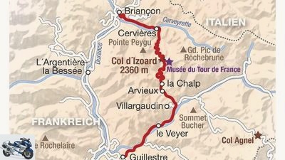
Well signposted in Briançon, after a short climb it first descends a few kilometers. This is followed by the ‘wonderfully flowing ascent through a narrow valley. The first hairpin only comes after eleven of 17 kilometers of the ascent. The descent is sometimes a little steeper with perfectly paved hairpin bends.
Werel
The route over the Col D’Izoard.
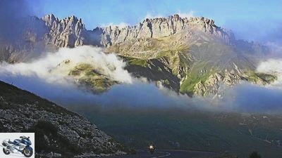
A unique landscape adds to the greatest driving pleasure. A few kilometers behind the top of the pass, the Casse Deserte (picture above) entices you to take a photo stop on the descent. Pointed rock needles rise high from sand-colored scree slopes. The rocks stand on a trellis for Fausto Coppi. The French erected a monument to the Italian cycling legend there. The Izoard has already been on the Tour de France program over thirty times.
2nd place: Col de la Bonette
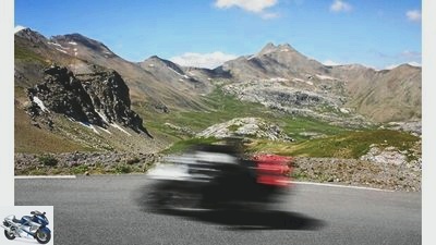
Lengwenus
The Bonette offers every type of curve – and extremely varied.
Length: 49 kilometers • Height 2802 meters • Opening times: July to October • Maximum gradient: 14 percent • Special features: The highest alpine pass ever
It would have been easier and flatter, but in order to secure the title of “highest alpine road”, the French government had the connection between the Ubaye valley and the Tinee valley built over the higher Bonette instead of the Col de la Moutière. The road is wide, in good condition and mostly easy to see in the high alpine, open landscape.
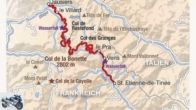
Werel
The route over the Col de la Bonette.
The Bonette offers every type of curve – and extremely varied. If you leave the upstream rock breakthrough of the Col de Restefond (2676 meters) to the left, you will come to the top of the pass shortly afterwards. There is a magnificent panorama with a 270 degree viewing angle. From here you can admire the entire mountain range of the Southern Alps on a clear day.
Our tip: The 60 meter high ascent to the Cime de la Bonette offers the full all-round view.
3rd place: Col du Galibier
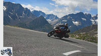
Lengwenus
The Galibier is one of the sacred mountains of the Tour de France. For motorcyclists it is a pleasure without any torture.
Length: 44 kilometers • Height: 2646 meters • Opening times: June to October • Maximum gradient: 12 percent • Special features: actually consists of three passes
The peaks are so rugged that even the snow struggles to find a hold. In the north, on a clear day, the Montblanc rises from the sea of mountains. The Galibier offers fantastic views. The pass itself is so monumental that it has two other passes as a promontory. From the south, the rather boring Col de Lautaret, which is around 2000 meters high, has to be climbed before the actual Galibier route winds its way up the mountain for around eight kilometers to the right. Caution is advised on the driveway.
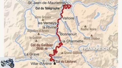
Werel
The route over the Col du Galibier.
The route is not very wide, bumpy and partly without any limitation. The journey to Valloire, 14 kilometers to the north, on the other hand, is wider and more fluid. It gets really curvy behind the ski resort on the tarred patchwork of the 1500 meter high Col du Telegraphe with its dozen hairpin bends.
4th place: Col de l’Iseran
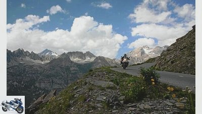
Lengwenus
From the rugged mountain landscape to the lush green high valley, the Iseran offers a wide variety of views.
Length: 49 kilometers • Height 2770 meters • Opening times: June to October • Maximum gradient: 12 percent • Special features: the most varied
It would be the highest pass in the Alps if the builders of the Bonette hadn’t artificially gained a few meters with an extra loop. It still remains a superlative for him: no other pass is so varied in landscape. Only so breakneck glued to a glaciated mountain massif on the mountain flank that a missed bend apparently leads directly to the roofs of the pretty village of Bonneval does it suddenly turn into a green high valley with a torrent.
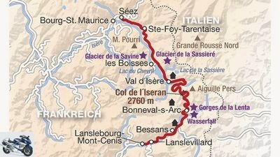
Werel
The route over the Col del’Iseran.
After a rock breakthrough, a barren rocky landscape follows, which even has remains of snow in midsummer. Behind the wind-blown pass with a fortress-like Auberge, the road plunges down towards Val d’Isère, but then suddenly turns again into the next side valley. The Iseran is also very versatile in terms of driving.
5th place: Col d’Allos
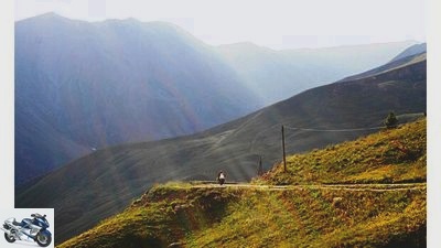
Lengwenus
The Col d’Allos offers wonderful landscapes on comfortable curves.
Length: 43 kilometers • Height: 2250 meters • Opening times: June to October • Maximum gradient: 11 percent • Special features: narrow, but fun
When there is plenty of oncoming traffic, the fun has its limits, because the road is one and a half lanes with good will on the 16 kilometers south of Barcelonnette. In the mornings and evenings, the narrow strip of asphalt that makes its way along a wild river is a real treat. After the first few kilometers in the slalom between the rock face and the little wall, it goes through the high forest in the same rhythm.
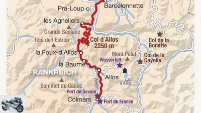
Werel
The route over the Col d’Allos.
The curves are tight, but short and almost free of bends. The upper part is open and slightly humped. The descent through a ski area is also fun, only the retort ski village of Foux d’Allos and the road that has been built for a few kilometers to be suitable for bus use spoil the pleasure before it gets narrower and more demanding again. Our tip: take a stroll through the market in the medieval village of Colmars.
6th place: Cormet de Roselend
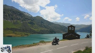
Lengwenus
The Cormet is an insider tip in terms of both driving and landscape.
Length: 43 kilometers • Height: 2250 meters • Opening times: June to October • Maximum gradient: 11 percent • Special features: narrow, but fun
When there is plenty of oncoming traffic, the fun has its limits, because the road is one and a half lanes with good will on the 16 kilometers south of Barcelonnette. In the mornings and evenings, the narrow strip of asphalt that makes its way along a wild river is a real treat. After the first few kilometers in the slalom between the rock face and the little wall, it goes through the high forest in the same rhythm.
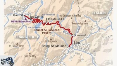
Werel
The route over the Cormet de Roselend.
The curves are tight but short and almost free of bends. The upper part is open and slightly humped. The descent through a ski area is also fun, only the retort ski village of Foux d’Allos and the road that has been upgraded for a few kilometers to be suitable for bus use spoil the pleasure for a short while before it becomes narrower and more demanding again.
Our tip: Stroll through the market in the medieval village of Colmars.
Place 7: Col du Petit St. Bernard
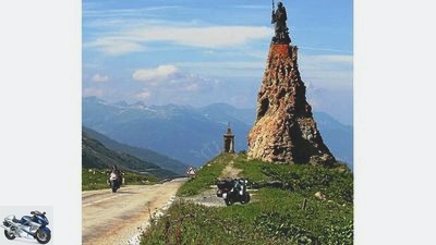
Lengwenus
the “little Saint Bernard” leads from the Isère valley to the Aosta valley in Italy.
Length: 51 kilometers • Altitude: 2188 meters • Opening times: May to November • Maximum gradient: 10 percent • Special features: one of two passes that lead to Italy
Fought hard between France and Italy in the Second World War, the Roman Jupiter statue had to give way to St. Bernard of Menthon after the French victory. The “little Saint Bernard” leads from the Isère valley to the Aosta valley in Italy. After a few settlements, the cracked slope curves in a varied way through the forest.
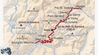
Werel
The route over the Col du Petit St. Bernard.
The road is two-lane throughout on the French side, the easy-to-drive hairpin bends rise gently and are slightly elevated on the outside. After a desolate ski village, the route turns into a green side valley. The final ascent has only one bend over eight kilometers. The top of the pass with its hospice, pizzeria, souvenir shops and abandoned border buildings crosses the border in a dead straight line, the more winding it is on the narrower route into the valley.
8th place: Col Agnel
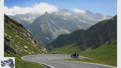
Lengwenus
The Col Agnel is angular on the Italian side, the French route is so fast that some bikers have to cool their heads.
Length: 52 kilometers • Height: 2746 meters • Opening times: June to October • Maximum gradient: 11 percent • Special features: very curvy in the east, almost an expressway in the west
The pass, also known as Colle dell’Agnello, connects the Italian province of Cuneo with the French Queyras valley. The first ten kilometers on the Italian side to Chianale are brisk and flat, then the fourth-highest alpine pass with a few steep turns creates respect. Then a high valley awaits with awe-inspiring rock faces. It goes smoothly along the torrent.
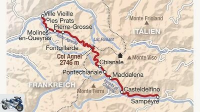
Werel
The route over the Col Agnel.
Caution: Not all grazing cows are fenced. While the Italian part impresses with a stone arena after further bends, the French side looks less spectacular. The road into the valley is in excellent condition and sometimes very fast. It tempts you to go fast, but sometimes turns sneakily around the corner. The top of the pass sits on a tiny saddle that occasionally causes parking problems even for motorcyclists.
9th place: Col de la Cayolle
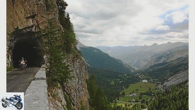
Lengwenus
The characteristics change as well as the street width and the surface.
Length: 51 kilometers • Height 2326 meters • Opening times: July to October • Maximum gradient: 11 percent • Special features: the flat sections are the most fun
From the south, the Cayolle cradles the rider with a flat and quick approach to safety, but rises steeply after Entraune’s turn after turn. The characteristics change as well as the street width and the surface.
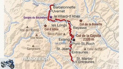
Werel
The route over the Col de la Cayolle.
That creates variety, but doesn’t make it easier to find a rhythm. Lots of bends sneakily close. The descent on the north side is a narrow mogul slope. The lower part in the 20-kilometer-long Ubaye Valley compensates for this.
Place 10: Col de Vars
Lengwenus
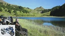
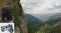
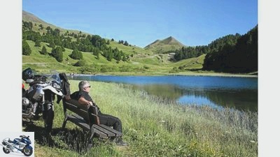
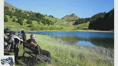
The route of the Col de Vars is exciting, the mountain lake, on the other hand, has a calming effect.
Length: 34 kilometers • Height: 2109 meters • Opening times: May to October • Maximum gradient: 11 percent • Special features: ascent with almost no switchbacks
In Guillestre it is best to first follow the signs to the village of Vars. After a few bends, it first goes a few kilometers downhill.
Werel
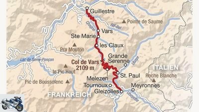
The route over the Col de Vars.
Then the road climbs on almost perfect asphalt without a single further bend in beautiful curves to the inconspicuous pass summit. The descent to St. Paul d’Ubaye is narrower, bumpier and more winding.
Related articles
-
On the go: the best passes in Austria
bull 25th pictures bull 1/25 Place 9: Nassfeld Pass – The landscape and route of the Passo di Pramollo are attractive, but the poor asphalt often draws…
-
Route guide: The best passes in the Pyrenees
shepherd 25th pictures shepherd 1/25 The routes on the Spanish side are often better developed, while the French side is more winding and adventurous….
-
On the go: the best alpine passes in Italy
Breakable 30th pictures Breakable 1/30 The route over the Sella Joch. Breakable 2/30 3rd place: Passo di Gavia – The pass is an alpine pleasure trip, not…
-
Alpine passes in northern Italy: the forgotten passes
Breakable 18th pictures Breakable 1/18 1st place: Passo del Vivione – Length: 57 kilometers • Height: 1827 meters • Opening times: May to October •…
-
Top 100: The most important and most beautiful alpine passes
Deleker 29 pictures Breakable 1/29 The Bernardino spoils you in parts with curves that you don’t want to drive just once (here in the southern part of…
-
The 10 most beautiful German alpine roads
shepherd 22nd pictures shepherd 1/22 The route – length: 23 kilometers • altitude: 894 meters • maximum gradient: five percent • no tolls • special…
-
50 alpine passes for motorcyclists
Jo Deleker 44 pictures Map: OpenStreetMap 1/44 Col des Aravis in France: 1,486 meters. Well developed, scenic. Map: OpenStreetMap 2/44 Col de l’Arpettaz…
-
The ten best alpine passes in Switzerland
Drawing: Hornig 29 pictures Breakable 1/29 The Bernardino spoils you in parts with curves that you don’t want to drive just once (here in the southern…
-
PDF download The best passes in Europe
Breakable Sports & scene PDF download The best passes in Europe PDF download The best passes in Europe That fits! The number 1 motorcycle area in Europe…
-
MOTORCYCLE tour tip – Switzerland passes tour
Tour tips Exclusive motorcycle tours for children to follow Presented by Dirk Schafer to travel MOTORCYCLE tour tip – Switzerland passes tour MOTORCYCLE…