Table of contents
- Tour planner software in comparison Delicious motorcycle tour at the push of a button?
- The device can only calculate, not think
- Tour at the push of a button – the self-experiment
- Advantages of online route planners
- Challenges in online route planning
- This must be taken into account for tours that have already been created
- www.motoplaner.de
- www.tyretotravel.com/de
- www.mopedmap.net
- www.maps.motorradonline.de
- www.lerito.net
- www.easyroutes.de
- Great motorcycle tour at the push of a button?
- Interview with Daniel Lengwenus
- Conclusion
Dentges

16 pictures
Bearing
1/16
… In the meantime, hikers, runners, inline skiers and motorcyclists can also use the planner as an exchange platform for interesting tours.
mps photo studio
2/16
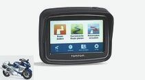
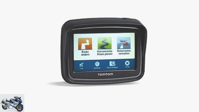
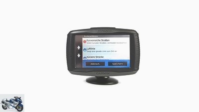
… the navigation system offers winding roads, …
Bearing
3/16
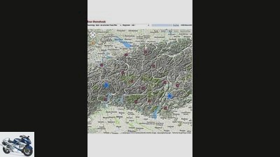
www.mopedmap.net: The planning software was originally created in 2007 for cyclists. The idea: cyclists create a route that can later be found and used by other users …
Dentges
4/16
Tell me where the curves are …
Bearing
5/16
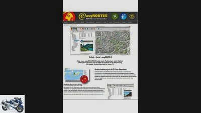
… In contrast to the freeware presented here, the installation costs a one-time fee of 19.90 euros.
Bearing
6/16
www.easyroutes.de: This tour planner costs money …
Bearing
7/16
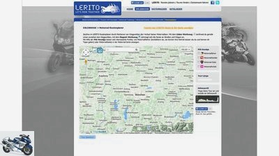
… Motorcycle manufacturer BMW initiated the portal with the idea of finding friends for trips, tours and trips.
Bearing
8/16
www.lerito.net: A good 8000 registered members cavort at Lerito (stands for: “Let’s ride together!”) …

Sdun
9/16
The chief tour guide Dani Lengwenus (52) has been leading motorcyclists to the most beautiful routes around the world for the MOTORRAD action team for over 20 years.
Bearing
10/16
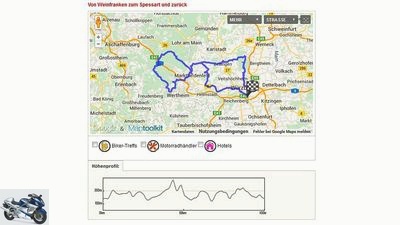
… Because not only users freely provide their (unchecked) tours on the pages for download, but also the professional travelers of MOTORRAD.
Bearing
11/16
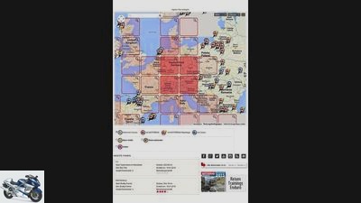
www.maps.motorradonline.de: The biggest advantage of MOTORRAD’s own free tour planner is the good selection of editorially selected tours …
Bearing
12/16
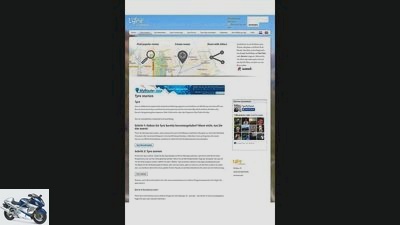
www.tyretotravel.com/de: The free tour planner Tire, developed by the Dutchman Jan Boersma in 2006, is recommended by the Dutch motorcycle navigation system manufacturer TomTom.
Bearing
13/16
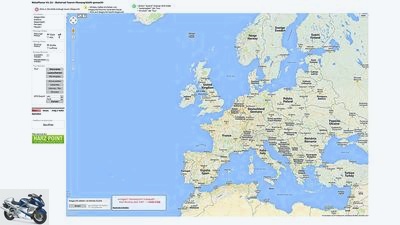
… Except for “Avoid Autobahn and Toll Roads”, however, there are few planning options on offer, and motorcycle-specific content and already tried and tested motorcycle tours for download can only be found on an interconnected website on motorcycle tourism in the Harz Mountains.
Bearing
14/16
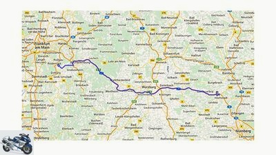
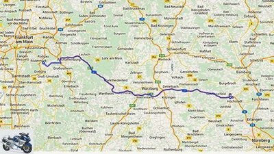
www.motoplaner.de: The clear Motoplaner focuses quite simply on the routing functions …

Dentges
15/16
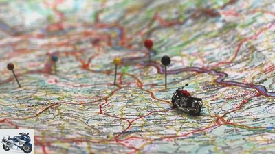
Motorcycling is more fun if you don’t miss the best routes. You can do that if you rely on electronic tour planners?
mps photo studio
16/16
… but unfortunately also ugly routes.
accesories
Navis, communication, apps
Tour planner software in comparison
Tour planner software in comparison
Delicious motorcycle tour at the push of a button?
Driving around without a plan? It’s totally okay. Because motorcycling is fun. But it’s more fun if you don’t miss the best routes. You can do that if you rely on tour planner software?
Thorsten Dentges
02/05/2015
In the past, a route was staked out on the map with needles and thread or the kilometers to be traveled were calculated from the distance information, the time required for the stages was estimated – and people were happy to miscalculate. Much to the annoyance on the way when the targeted accommodation could only be reached at night and thus blocked.
Buy complete article

Tour planner software in comparison
Delicious motorcycle tour at the push of a button?
8 pages) as PDF
€ 2.00
Buy now
In the digital age there is a wide range of electronic route planners, for example maps.google.de, maps.adac.de, ViaMichelin and other planners. They should be able to spit out suitable routes and additional information and, to top it off, are usually also available for free on the Internet. Or they are included in the scope of delivery of a navigation device, such as the Garmin Basecamp software, with which routes, tracks and waypoints can be exchanged. However, this software is optimized for Garmin devices. We have therefore selected and compared six other designated motorcycle tour planners.
The device can only calculate, not think
But what help do motorcycle-specific tour planners really offer? It is clear that motorcyclists – unlike most motorists – do not want to get from A to B as quickly as possible when creating a route. Side routes, detours to sights and stops at popular motorcycle meeting places are what make motorcycle touring so attractive. GPS devices like Garmin Zumo or TomTom Rider offer a special function to guide the route over winding roads. A small self-experiment showed that this unfortunately only partially guarantees that you will actually find exciting routes.
The explanation is simple: the device can only calculate, not think. According to defined parameters, it calculates how many curves can be counted on the respective route sections. Modern devices also take the elevation profile into account. The information about what counts as a curve, i.e. how strong and how long the road bends, is also a variable defined by the programmer that is incorporated into the parameter. That explains why the different devices make different tour suggestions at the push of a button.
Buy navigation accessories at markt.motorradonline.de

technology & future
Motorbike sat navs and apps in the test
Navigation devices for motorcyclists
read more
Tour at the push of a button – the self-experiment
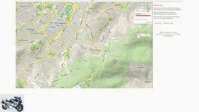
In practice, the function is often of little help, as the MOTORCYCLE driving test in the Black Forest showed. In Sindelfingen near Stuttgart, the navigation devices guided the driver through the middle of a high-rise area – just because half a dozen tired curves were waiting there. In the wasted time, another driver who would have left the densely populated agglomeration area directly could have long been on a really attractive motorcycle route.
On the other hand: Far away from the metropolitan areas, for example in the middle of the Black Forest, the motorcycle navigation systems can spit out the most beautiful routes at the push of a button. If you start in Freudenstadt and enter Freiburg as your destination, the devices will guide you fairly safely over routes with a high level of adventure. In such a case, you can actually drive off aimlessly and get a delicious tour served at the push of a button. Well, the chances are not bad that you will end up on these routes with your mouth free. However, it is more of a coincidence whether you will arrive at the desired destination at some point. Another advantage: if necessary, the shortest route to the destination can be calculated at any time, which encourages spontaneity.
Advantages of online route planners
At the moment, a good tour requires planning skills similar to the good old-fashioned pin method. However, the bottom line is that digital planners offer many advantages. Planning on the large computer screen is more convenient than directly on the navigation device with its comparatively small display. And unlike planning with paper road maps, good programs offer optimized input and switching options to different maps (pure road maps, topographical maps, terrain maps and even satellite displays). The software can also automatically place the “thread” on the digital road between the user-defined waypoints with a click of the mouse and determine the distance and time for this section of the route.
With some planners, routing options can be set so that, for example, motorways are disregarded, but petrol stations or sights are displayed. That is practical. Depending on the tour planner, accommodations can even be booked directly with an internet connection. If you want to discard an unsuitable section of the route or the entire tour, one click is enough. In contrast to setting pins, you don’t leave any perforated paper map material behind. However, at first you don’t have a solid card to put in your tank bag. The tour worked out on the computer must therefore first be printed out. A small road book with text information, which is combined with a conventional road map, makes the most sense. However, exporting the digitally created tour to your own navigation device is more contemporary.
Challenges in online route planning
However, the tour then necessarily runs along all waypoints. Deviating from intermediate destinations can sometimes disrupt the entire route. Creating too many points can also be problematic, especially when planning very long stages. Tip: When planning on the computer, it is better to divide a mega stage into several small sections and not set more than 50 routing points.
A main problem when transferring the planned route to the navigation device: the computer and navigation device should access the same map material in the current version, otherwise errors can occur when the route is transferred to the navigation device. It is advisable to synchronize each transmitted tour on the computer screen and navigation display before leaving to avoid a painstakingly prepared tour in the wild being worthless.
This must be taken into account for tours that have already been created
If you want to save your own planning work, you will find numerous tours that have already been created to download on the Internet. Most of the time, however, it is only recorded GPS data that is offered on countless private websites and in public places on the Internet, for example with some of the tour planners presented here, but also on file sharing networks and platforms such as www.gpsies.com, www.alpenrouten.de or www.motouren.de. If you take over the unfiltered data that has not been checked by any supervisory authority, no one needs to be surprised when routing includes every detour through missed turns and pee stops. Although every user can edit the tours on their home PC, tours that have already been edited and checked by professionals are definitely more fun on the route.
Important when downloading: select the appropriate file format for the respective device (.gpx for Garmin, .itn for TomTom, .kml for Google Earth, for example when navigating with a smartphone). After the data transfer, the files can be found in the specified download directory on the computer. If you connect the navigation device to the computer, it is usually recognized as a drive. The file can then be imported into the corresponding directory on the navigation device as a so-called track and, depending on the device, must be converted into a route in a few simple steps in order to be able to use voice output and turning instructions. So, done, you are now fully on schedule. And then what? Well what, turn the ignition key and off you go!
traffic & business
Motoplaner stops
Route planning tool stops operating
read more
www.motoplaner.de
Bearing
www.motoplaner.de.
Export winner
The clear Motoplaner focuses quite simply on the routing functions. Except for “Avoid Autobahn and Toll Roads”, however, there are few planning options on offer, and motorcycle-specific content and already tried and tested motorcycle tours for download can only be found on an interconnected website on motorcycle tourism in the Harz Mountains. Tours created by users themselves can, however, be passed on. Class: the map material.
Seven different formats are available for switching with a click of the mouse, from Open Streetmap and Google Street to relief and satellite representations. Top: the umpteen different export options, sorted according to device types, formats, manufacturers and smartphone apps.
Update from May 2018: The online tour planner motoplaner.de will be switched off by the operator / developer on May 25, 2018. You can read all the information here: motorradonline.de/motoplaner-verschaltung
www.tyretotravel.com/de

Bearing
www.tyretotravel.com/de.
The planning Dutchman
The free tour planner Tire, developed by the Dutchman Jan Boersma in 2006, is made by the Dutch motorcycle navigation system manufacturer TomTom recommended. But it also works with Garmin sat navs and other devices. After a rather complex registration and installation, the software offers numerous functions.
For example, points of interest (POIs) can be transferred directly from the navigation device to the map when planning, hotels on the route can be booked directly, GPS data is displayed in a clear list of stations, and individual waypoints can be conveniently renamed without therefore having to change the whole tour. Tire is heavily tailored to sat nav devices (especially from TomTom). Good: a link to a tour collection of the tire community.
www.mopedmap.net
Bearing
www.mopedmap.net.
Two-wheeler exchange
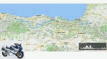
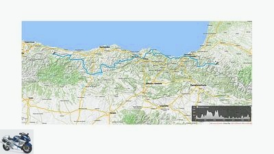
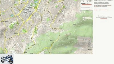
The planning software was originally created in 2007 for cyclists. The idea: cyclists create a route that can later be found and used by other users. In the meantime, hikers, runners, inline skiers and even motorcyclists can use the planner as an exchange platform for interesting tours. The displayed altitude profile (see picture) along the route is great. Experienced touring riders can interpret certain routes more easily (many meters in altitude over a few kilometers promise winding, demanding routes).
Unfortunately, the software takes a long time to load and, depending on the system, runs hacky and sometimes crashes completely. Practical when creating a route is the so-called magnetic tool, with which you can draw your route on the Google-based map material (five maps, plus two special maps). The embedded Google search for finished tours appears somewhat unstructured because it has not been edited.
www.maps.motorradonline.de

Bearing
www.maps.motorradonline.de.
Tours by professionals
The biggest advantage of MOTORRAD’s own free tour planner is the good selection of editorially selected tours. Because not only users make their (unchecked) tours available for download on the pages, but also the professional travelers from MOTORRAD. Good route quality is therefore guaranteed on these routes. In addition, there is data on biker meetings, motorcycle dealers and hotels in the targeted area.
The elevation profile is displayed for route guidance. Over 2000 tours (with a focus on Europe) are on offer worldwide, a report on a good 200 of them. A short registration is required to create a route yourself. The tracks created on Google and OSM maps can be downloaded stress-free as GPX, KLM or ITN files.
www.lerito.net
Bearing
www.lerito.net.
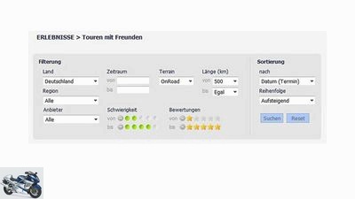
find friends
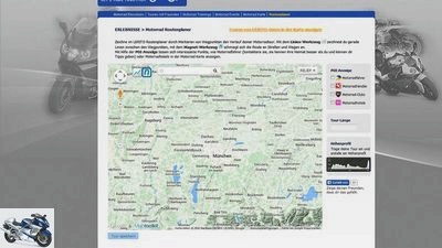
A good 8,000 registered members cavort at Lerito (stands for: “Let’s ride together!”). Motorcycle manufacturer BMW initiated the portal with the idea of finding friends for trips, tours and trips. There are tour tips with information on length, degree of difficulty, date and meeting point. Users should also create tours themselves and offer them to other drivers at Lerito.
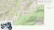
This works foolproof: With a line tool you draw the rough course of the tour between individual waypoints, then the route is adapted to the corresponding roads using a magnetic tool. The POI display shows other motorcyclists (for possible appointments), dealers, hotels and clubs in the planning map. The good map material comes from Google and Open Street Maps (OSM).
www.easyroutes.de
Bearing
www.easyroutes.de.
Privacy protected
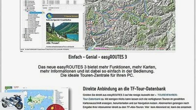
This tour planner costs money. In contrast to the freeware presented here, the installation costs a one-time fee of 19.90 euros. In return, the customer receives comprehensive planning software with motorcycle-specific content (a good 400 tours, some subject to a charge) and its own database. Tours that you have created yourself and those of others can be managed behind closed doors.
The user specifies the directory structure, sorts routes according to his own taste and can pass the data on to other Easyroutes users. The maps are from Google and Open Street Map. The software automatically recognizes the respective navigation device, and a special thread tool helps when creating a route. However, you should study the operating instructions beforehand, because creating a tour requires certain basic knowledge.
Great motorcycle tour at the push of a button?
Special motorcycle navigation devices have promising special functions: “Plan a winding route” (TomTom) and “Route preference: winding roads” (Garmin), for example. Great, does it serve delicious routes? MOTORRAD wanted to know. Test drive 1: Destination Schorndorf, east of Stuttgart, around 20 kilometers. On the left is the expressway, which is easy to calculate for the navigation system, on the right is a ridge of the Schurwald that is attractive for motorcyclists. Garmin sends the driver on a completely uninteresting route through industrial areas with high-voltage lines. That is around three kilometers more than the shortest route on the expressway. The TomTom device, on the other hand, chooses the beautiful mountain route via Schnait, the detour is seven extra kilometers, but it is worth it.
Test drive 2: destination Niedereschach in the Black Forest, approx. 120 kilometers. Both devices lead out of Stuttgart via absurd routes and get lost unnecessarily in residential areas of upstream cities. Garmin routes into a closed dirt road – dead end! More than an hour has passed before the first attractive motorcycle route is due, and in the end less than 20 percent of the route was worth it. Bottom line: nice tour at the push of a button? Unfortunately, it doesn’t really work.

to travel
Excursions, tours, travel 2013 – tips for great experiences
Seven dreams
read more
Long-distance travel with the MOTORRAD action team
Interview with Daniel Lengwenus

Sdun
Daniel Lengwenus, chief tour guide at the MOTORRAD action team and an experienced tour planner.
“Computers are too stupid”
The chief tour guide Dani Lengwenus (52) has been leading motorcyclists to the most beautiful routes around the world for the MOTORRAD action team for over 20 years. He also uses planning software to prepare his tours, but under no circumstances would he rely on it alone.
Dani, do you fear that tour planner programs could replace you??
Haha science fiction huh? No, seriously, fortunately that is still a utopia, because after all there are still significant differences between humans and computers. After all, man has feelings.
And? What exactly does this have to do with route planning?
So. In my opinion, having fun is one of the most important sensations in humans and at the same time one of the most important factors in riding a motorcycle. A computer has no feelings and will therefore not be able to create a tour from the point of view of fun. A program can certainly calculate a direct and time-saving route better and, above all, faster than humans. But how should the computer know which route is really fun?
But in some route planners there are tours that have already been entered, stored “points of interest” and even information on where motorcycle meet-ups can be found?
That’s correct. And supports my thesis. After all, it is precisely these sophisticated route plans that have mostly been put together by motorcyclists who use them to make their favorite routes accessible to others. The computing function of the software cannot do this alone.
So the fun falls by the wayside?
If you rely solely on electronic route planners, you certainly won’t have one on the way. An example: when I wanted to incorporate the fantastic Col de la Bonnette into a tour, some of the programs refused to visit it, for whatever reason. Still, I’ve ridden the route a lot and I know that it will work without any problems. A shame for everyone who lets the planner take away such a highlight.
Why do such mistakes happen?
I think these are classic programming errors. After all, people input their knowledge into the computer. Given the mass of information, it seems that errors cannot be ruled out. A few years ago, when I was standing in thick fog with tour participants on the Pyrenees ridge, the software wanted to send me over the ridge to a hiking trail. Thank goodness I always have the right road map in front of me in the tank bag and was able to compare it. That’s why we made the right turn and reached the hotel in good time on safe tarmac. The electronic signpost would have led us off the beaten track and thus perhaps into disaster.
Why do you still use the planning software??
At the desk it is simply the fastest and most comfortable way to plan daily stages. But that only works if you are familiar with the target area.
So what’s the best way to go about planning a tour?
I recommend placing a very good road map on a scale of 1: 200,000 next to the computer and choosing the route on it. You can then enter this one-to-one into the software and receive the desired information such as route length, duration, sights and hotel at the destination. The goal is often only derived from the calculated stage length.
So a conventional road map is essential?
Exactly. Because this belongs in the card compartment anyway, otherwise you quickly lose track and are at the mercy of the electronics for better or for worse.
What are the most important advantages of tour planners??
My tip: Let them do the annoying math and use them as an aid, but don’t let them dictate the entire tour for you!
Conclusion
Dentges
Tour planning is exhausting. Work before pleasure!
Digital motorcycle tour planners can do a lot, but are by no means a guarantee for successful trips and trips. Please don’t forget: Most of the planners are available free of charge! And even good computing power does not replace common sense and manual planning. So it remains: Tour planning is exhausting. Work before pleasure!
Related articles
-
Five motorcycle navigation devices in a comparison test
mps photo studio 24 pictures Lohse 1/24 Thorsten Dentges tested five motorcycle sat navs from Becker, Garmin, TomTom and NavGear. Dentges 2/24 NavGear…
-
shepherd to travel Motorcycle tour in Morocco Motorcycle tour in Morocco Side effects welcome As one of the world’s most diverse countries, Morocco is an…
-
MOTORCYCLE tour tip – Ore Mountains
Tour tips Exclusive motorcycle tours for children to follow Presented by Gerhard Eisenschink to travel MOTORCYCLE tour tip – Ore Mountains MOTORCYCLE…
-
Photo: Koch 43 pictures fact / Joachim Schahl 1/43 fact / Joachim Schahl 2/43 fact / Joachim Schahl 3/43 fact / Joachim Schahl 4/43 fact / Joachim Schahl…
-
MOTORCYCLE tour tip – Dolomites North
Tour tips Exclusive motorcycle tours for children to follow Presented by Jorg Kunstle to travel MOTORCYCLE tour tip – Dolomites North MOTORCYCLE tour tip…
-
MOTORCYCLE tour tip – Osttirol Runde
Tour tips Exclusive motorcycle tours for children to follow Presented by Jorg Kunstle to travel MOTORCYCLE tour tip – Osttirol Runde MOTORCYCLE tour tip…
-
MOTORCYCLE tour tip – Ostalb: Ellwangen-Heidenheim
Tour tips Exclusive motorcycle tours for children to follow Presented by Jorg Kunstle to travel MOTORCYCLE tour tip – Ostalb: Ellwangen / Heidenheim…
-
markus-jahn.com 25th pictures markus-jahn.com 1/25 Gravel tour over the Swabian Alb. markus-jahn.com 2/25 Matthias and his KTM ventured out onto the…
-
Seitz to travel Alpine winter tour Alpine winter tour Winter for cold showers When the sun licks the ice off the streets for a short time, the…
-
Energica comparison with Tesla: CEO wants competition
manufacturer motorcycles Electric Energica comparison with Tesla: CEO wants competition Energica compares itself to Tesla Energica boss wants more…